NYC 311, with help from Stack Exchange, held the Reinvent 311 Mobile Content Challenge, which called on developers to use NYC’s revamped Open 311 Inquiry API to make city information more readily available on people’s mobile devices.
I started out focused on education data, but it was messy and too loosely organized to be of any immediate use. If you want to extract meaningful information from it, you could, but it would take some cleaning up and organizing to make useful. It isn’t as easy as displaying an API call from a mobile device.
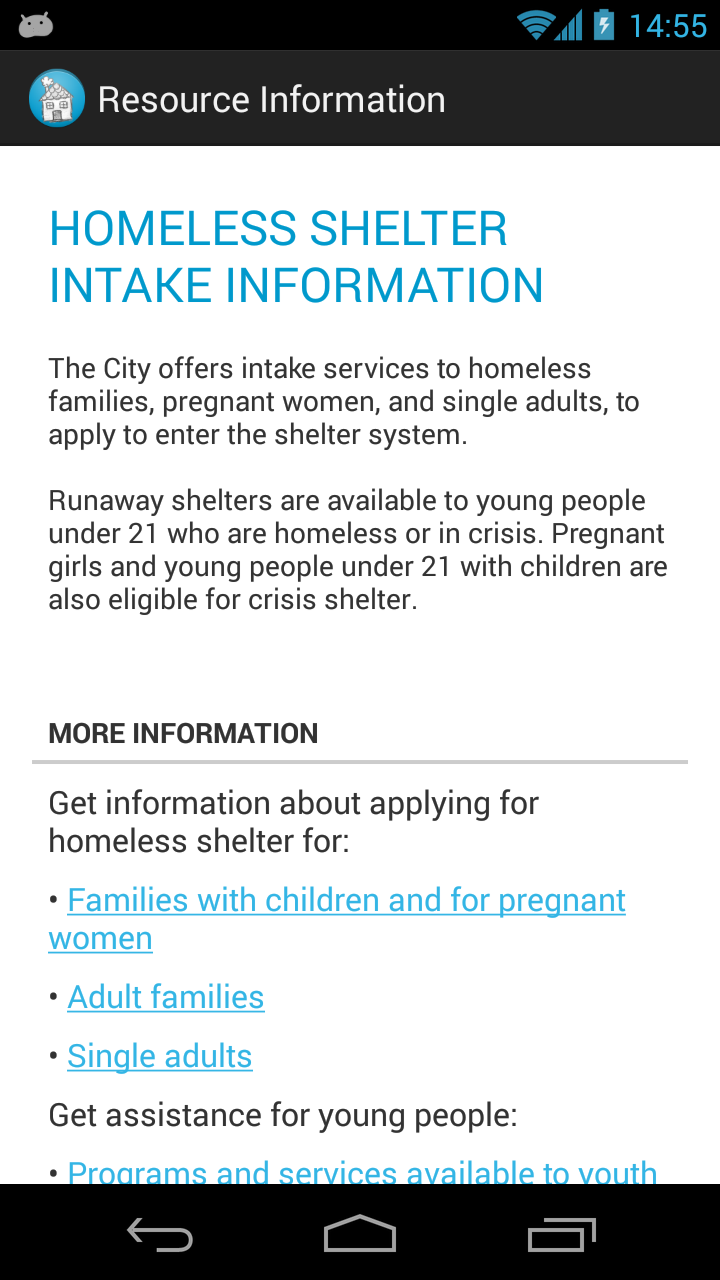
After looking through more of the available data and consider the different use cases, I settled on an app designed to help homeless people in the city. This seemed like a terrible idea at first — how do you use technology to help those without access to it?
A few ideas came to mind. A map of food banks and soup kitchens (along with directions) could be useful. There were also lists of intake shelters online, but no coherent sets of shelters, so a map of shelters would also be useful. Finally, there were also information-based services that the city offered — information on food stamps, homeless prevention, youth counseling, job services, and other outreach information. Putting all of this data together wouldn’t be terribly difficult, and it would create an app that someone might find helpful. Homeless people typically don’t have access to smartphones, but outreach groups like Coalition for the Homeless could use technology to help those without it.

The app is modeled after the data from the API, with different objects for each type of API response. This allowed me to easily create maps give any set of facilities (shelters, food banks, etc.), and information pages given any city service. In this sense, the Open Inquiry API’s design has allowed for flexibility in adapting the app to easily include more data.
One of the main strengths of the Open 311 API is that once an app is created for one city, it should be seamlessly compatible with data from another city, since the API calls are all the same — all that changes is the city that serves up the data. This is a fantastic ideal outcome, but the implementation is slightly off, especially in this particular use case. The data I used needed minor refinements — nothing extreme, but I had to manually decide which services were relevant to this audience, since there is no “homeless” category. I also whipped up some quick Python scripts to add more useful latitude/longitude data from street addresses using the Google Maps Geocoding API.
Perhaps the biggest flaw in the data is the lack of information in API calls. One of the goals outlined by the people at NYC 311 was to reduce the number of calls to 311 asking for information that was readily available online. A mobile app is a great way to make this information more immediately available, but for most services, nothing more than a description was offered. The “More Information” and “FAQs” sections simply said “Call 311 for…” — the data isn’t useful if it simply redirects to the old method of calling for information.
Besides the lack of completeness and consistency in the city’s data, the potential for interesting tools and visualizations is clear. There’s a ton of data, the challenge is in sifting through it and making it easily usable.
The demo event itself was fantastic fun. The other contestants had impressive applications, most of which focused on low-income resources and real estate data. I met Joel Spolsky, who offered some sharp and honest advice for the contestants (think StackOverflow, but in person), Noel Hidalgo, who runs BetaNYC as a part of Code for America (check out their projects here), the talented people of StackExchange, designers from HUGE, and a gaggle of kind people from NYC 311. In the end, Homeless Helper NYC won a prize for “Best presentation of 311 information targeting a specific audience,” and it’s out now on the Play Store. You can also contribute to the source code on GitHub!